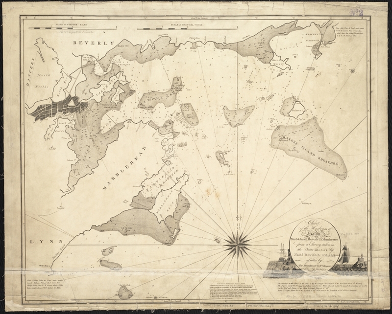
Chart of the harbours of Salem, Marblehead, Beverly, and Manchester, from a survey taken in the years 1804, 5 & 6
Item
- Title
- Description
- Contributor
- Coverage
- Creator
- Date
- Format
- Language
- Source
- Type
- Tag
-
Chart of the harbours of Salem, Marblehead, Beverly, and Manchester, from a survey taken in the years 1804, 5 & 6
-
From the Salem State University Archives: “This provides an “aerial” view of the harbors, waterways and hazards ships had to navigate (within close range of home) at the height of China/ East Indies trade. Offers a sense of the complexity/difficulty of the act of navigation.”Digital copy available at the Norman B. Leventhal Map Center.
-
Institution: Salem Public Library
-
Institution: Boston Public Library
-
Massachusetts--Essex (county)--Salem
-
Massachusetts--Essex (county)--Beverly
-
Massachusetts--Essex (county)--Marblehead
-
Massachusetts--Essex (county)--Manchester-by-the-Sea
-
Bowditch, Nathaniel, 1773-1838
-
1834
-
image/jpg
-
eng
-
Norman B. Leventhal Map Center.
-
cartographic
-
beverly
-
harbor
-
manchester
-
marblehead
-
Salem
- Item sets
- Salem Maps
Position: 7143 (3 views)

