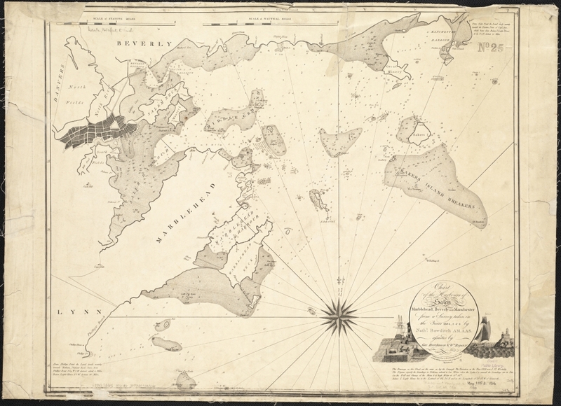
Chart of the harbours of Salem, Marblehead, Beverly, and Manchester, from a survey taken in the years 1804, 5 & 6
Item
- Title
- Description
- Contributor
- Coverage
- Creator
- Date
- Format
- Language
- Rights
- Source
- Type
- Tag
-
Chart of the harbours of Salem, Marblehead, Beverly, and Manchester, from a survey taken in the years 1804, 5 & 6
-
From Salem State University Archives: “This provides an “aerial” view of the harbors, waterways and hazards ships had to navigate (within close range of home) at the height of China/ East Indies trade. Offers a sense of the complexity/difficulty of the act of navigation.”Digital copy available at Norman B. Leventhal Map Center
-
Institution: Salem Public Library
-
Institution: Boston Public Library
-
Massachusetts--Essex (county)--Salem
-
Massachusetts--Essex (county)--Beverly
-
Massachusetts--Essex (county)--Marblehead
-
Massachusetts--Essex (county)--Manchester-by-the-Sea
-
Bowditch, Nathaniel, 1773-1838
-
1806
-
image/jpg
-
eng
-
It is possible to download images (including moderate and high .jpeg resolution) from Boston Public Library's Norman B. Leventhal Map Center website for use in school papers, research projects, or power point presentations. We request that you acknowledge the source with the tag line: "Map reproduction courtesy of the Norman B. Leventhal Map Center at the Boston Public Library."
In order to obtain higher quality TIFF images for reproduction in an academic publication or project, please email us at info@leventhalmap.org and we will send you a request form.
-
Norman B. Leventhal Map Center.
-
cartographic
-
beverly
-
harbor
-
manchester
-
marblehead
-
Salem
- Item sets
- Salem Maps
Position: 10408 (1 views)

