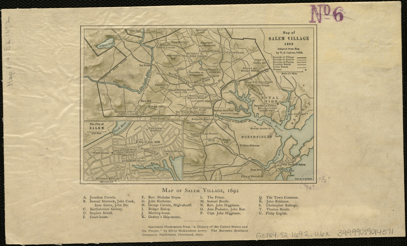
Map of Salem Village 1692
Item
- Title
- Description
- Creator
- Date
- Subject
- Publisher
- Rights
- Format
- Language
- Source
- Type
- Coverage
- Contributor
-
Map of Salem Village 1692
-
Map of Salem Village in 1692 along with property owners and historical buildings. Digital copy available at Norman B. Leventhal Map Center.
-
Upham, William P. (William Phineas), 1836-1905
-
1866
-
Salem Village (Mass.)
-
Danvers Alarm List Company, Inc.
-
It is possible to download images (including moderate and high .jpeg resolution) from Boston Public Library's Norman B. Leventhal Map Center website for use in school papers, research projects, or power point presentations. We request that you acknowledge the source with the tag line: "Map reproduction courtesy of the Norman B. Leventhal Map Center at the Boston Public Library."
In order to obtain higher quality TIFF images for reproduction in an academic publication or project, please email us at info@leventhalmap.org and we will send you a request form.
-
image/jpg
-
eng
-
Norman B. Leventhal Map Center
-
cartographic
-
Massachusetts--Essex (county)--Salem
-
Institution: Salem Public Library
-
Institution: Boston Public Library
- Item sets
- Salem Maps
Position: 7112 (3 views)

