Melrose Walks Maps
Item set
- Title
- Description
- Contributor
- Coverage
- Creator
- Date
- Format
- Publisher
- Rights
- Subject
- Type
- Original Format
-
Melrose Walks Maps
-
Walking tours of three neighborhoods in Melrose, Massachusetts: The Village, Main Street and East Side, Upham Hill, courtesy of the Melrose Historical Society.
-
Sponsors of Melrose Walks: Regan Real Estate, Marie T. Wood Real Estate, RE/MAX Heritage, C-21 Sexton & Donahue, Melrose Co-operative Bank, Coates & Fleming Printing, Brad Hutchinson Real Estate.
-
This project is supported, in part, by a grant from the Melrose Cultural Council, a local agency supported by the Massachusetts Cultural Council.
-
Institution: Melrose Public Library
-
Massachusetts--Middlesex (county)--Melrose
-
Melrose Historical Society
-
1996
-
application/pdf
-
Melrose, Ma : JFL Marketing & Advertising
-
Copyright - Melrose Historical Society, Inc. 1996
-
Melrose (Mass)--Maps
-
cartographic
-
maps
Items
-
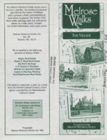
 Melrose Walks : The Village A map of a walking tour of The Village, courtesy of the Melrose Historical Society. This walk takes you through both residential and commercials areas between Melrose's two of three B&M railroad depots, Wyoming Station, and Melrose Depot. The Boston & Maine railroad came to Melrose in 1845. Within a few years of its arrival, the sleepy village of North Malden had become a desirable suburb. Click on image to view entire map.
 -
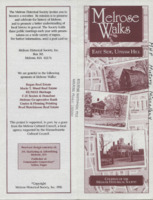
 Melrose Walks : East Side, Upham Hill A map of a walking tour of the East Side and Upham Hill, courtesy of the Melrose Historical Society. The tour takes you on some of the prettiest residential streets in Melrose. On route you will see fine examples of almost every style of Victorian architecture: Italianate, Second Empire, Queen Anne, Stick, Shingle and Colonial Revival. Click on image to view entire map.
 -
 Melrose Walks : Main Street A map of a walking tour of Main Street, courtesy of the Melrose Historical Society. Main Street is the business and civic center of Melrose. Here we find City Hall, the Central Fire station, Memorial Hall, the Baptist and Methodist Churches, the YMCA, and four blocks of businesses, banks, and restaurants. Click on image to view entire map.
