
Maps Overview
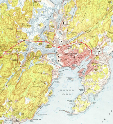
- Gloucester has a variety of maps and atlases in its collection. Some maps are of local interest, including street maps and maps of local landmarks and sites of interest. There are also geological maps of Massachusetts and nautical charts of the New England coast.
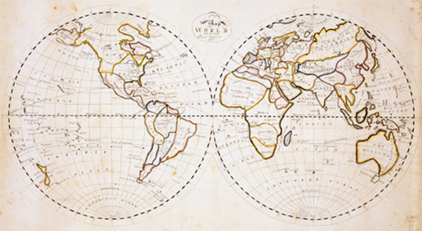
History of Cartography
Maps are the graphic representation of an area or physical space. They can be of the lands or bodies of water of the Earth, or of the astrological regions visible to humans. They can represent present conditions or historical ones. Maps can detail different aspects of the area they cover --- for example the geologic contours of a land mass or its streets and other man-made structures. Although it is not clear when cartography began, around 2300 BC it is known that Babylonians used clay tablets to record map-like images. Chinese mapmaking traditions date from about the same time. At that time, the Earth was thought to be flat. The concept of a spherical Earth started with the Greeks in the 6th century BC, but it took several centuries for that concept to be widely represented on maps. The invention of the magnetic compass in 1187 led to the development of sea charts, which depicted coast lines, islands, rivers, harbors, and features of sailing interest. Compass lines and other navigation aids were included. As exploration expanded, so did the breath and accuracy of maps. Science and technology has also contributed to an increase in the types of maps produced. Maps can now provide an abundance of understanding of the Earth and the universe.
Gloucester Map Collection
Gloucester has a variety of maps and atlases in its collection. Some maps are of local interest, including street maps and maps of local landmarks and sites of interest. There are also geological maps of Massachusetts and nautical charts of the New England coast. Atlases include street atlases of Essex county, Sanborn fire map of Gloucester, among others. While some maps reflect historical data, others are useful for discovering current locations. The sources of the maps vary, but many are from the Federal government. The publishing dates on the maps span from the late nineteenth century to present. Many maps are undated.
Access to the collection
All maps and atlases are available for use at the Library.
In addition, some maps have been transformed into digital images which can be access through this site:
LIST OF ITEMS
- Additional information about maps
To explore the world of maps, please visit these web sites: