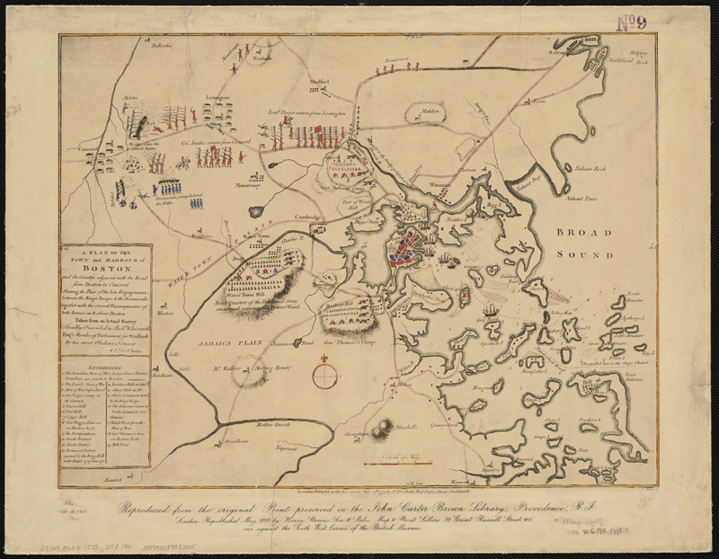
A Plan for the Town and Harbour of Boston
Item
- Title
- Description
- Creator
- Date
- Publisher
- Rights
- Format
- Language
- Coverage
- Contributor
- Type
- Tag
-
A Plan for the Town and Harbour of Boston
-
“A plan of the town and harbor of Boston and the country adjacent with the road from Boston to Concord showing the place of the late engagement between the King’s Troops & the provincials, together with the several encampments of both armies in & about Boston. Taken from an actual survey.
-
Digital copy available at the Norman B. Leventhal Map Center.
-
Physical copy available at the Salem Public Library, Boston vertical file.
-
Date Depicted: 1775
-
DeCosta, J.
-
1911
-
Henry Stevens, Son & Stiles
-
No copyright restrictions.
-
image/jpg
-
eng
-
Massachusetts--Suffolk (county)--Boston
-
Institution: Salem Public Library
-
Institution: Boston Public Library
-
cartographic
-
boston
-
concord
-
map
- Item sets
